Friday, May 04, 2018

Rock to Port Isaac

There are little balls of wet falling - what are they? Oh wait, it's rain! That wasn't forecast. Suits me, though, don't want it too hot. Today's target is Port Isaac where the fun starts (aka the Severe section) tomorrow. The trip had its moments today but all well eventually. Route summary and pictures on Komoot here.

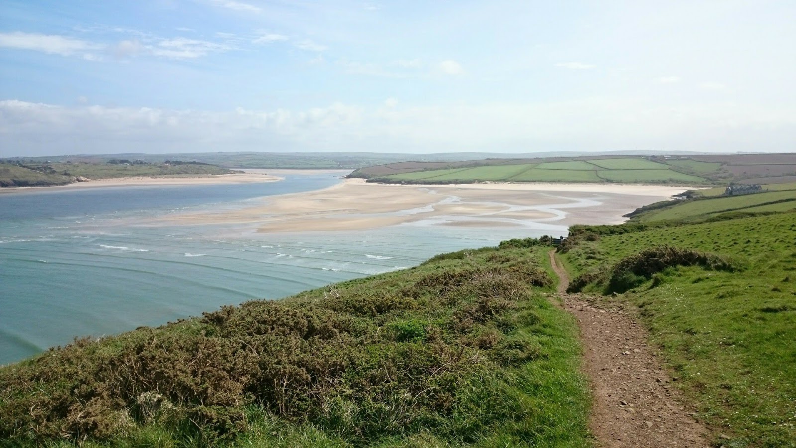
So goodbye to the Camel estuary, looking quite different this morning, not least as it's full of water today. Guess that happens a lot

Not the best day for photos as the mist persisted for most of the day I'm afraid. Polzeath was the first place on the route and judging by the size of the enormous car park it's fearfully busy in summer. You can see why as its a safe and surfing beach.
Polzeath is famous (?) for the fact that the Famous Five didn’t holiday here – in the first novel of the series the children expressed disappointment that their holiday was not to be spent, as usual, at Polzeath. It has been a favourite destination for both David Cameron and John Betjeman.

In 1991 the BBC used Polzeath as the eponymous location for “Tresoddit for Easter” – can’t say I remember it.


Just around the corner from this it all starts to get a bit rocky and I met a volunteer waiting for help to rescue this abandoned (by its mother) seal pup which had apparently been on the beach all night. It wasn't looking too bad but clearly needed attention. Apparently there's a seal sanctuary nearby.

It's not easy to see but (s)he's on the shingle just to the left of the rocks.


From there it's up to Pentire Point where, according to the book, there are the best views on the whole SWCP. Hmm, well not today. This view is looking North. Or maybe South. Not sure.
Actually it wasn't that bad 😀 but it was pretty misty. There's a plaque on the headland to say that the WW1 poem that I've already blogged about somewhere else was actually composed here. I'll let them fight it out. From here it's through the Rumps and the remains of a hill fort. You can just see the ramparts from the other side of the bay. Apparently.
The Rumps

All along here spring has really got going and the bluebells in particular were a sight.
They seem to thrive on hillsides here whereas I'm used to them being woodland plants. the garlic was powerful today as well and the foxgloves are just starting to appear.


The path is clear and well trodden from here and next up is Lundy Bay and the Lundy Hole

Lundy Bay

Lundy Bay


Lundy Hole
By now I'm starting to get peckish and looking forward to lunch - how habits have changed. One thoughtful friend (no names but you know who you are Pike) suggested I just might have more energy after stopping for "a little something" so I had hopes for Port Quin - just up the path and I'd get there spot on lunch time. Desolated to find that the OS showed no cafe, but elated to find a van selling BLTs among other health foods, and that the just-departing 16 teenaged hikers from New Jersey had left some for me. Guess what - Charlie was right: who knew?
Port Quin is tiny though for some reason I'd expected it to be bigger.

The cottages on the harbour are all holiday lets (as is the big house up the road) and it's really not a surfing beach so it was very quiet. Beautifully so. Although small now, the size of the fish cellars in Port Quin show it used to be quite prosperous. the economy was mainly based on pilchards but this was also where granite from Lundy quarries was landed. There were also some small local tin mines.

It also has, on a headland on the approaches to the harbour, an old Victorian folly - Castle Droyden, built about 1830 by a Samuel Symons (a late Regency bon viveur from Wadebridge). As I was taking a picture I remembered that this is where the fantasist pharmacist in Doc Martin goes loopy. You had to see it - too long to explain.

Much refreshed and refuelled, onwards and inevitably upwards onto Kellen Head. From here there would be a natural path along the drystone wall but because the farmer's fence is 30 ft downhill from that the path has to go through many convolutions to find a route along what's left. This means as you've probably sussed a lot of up and down. Still, good practice for the section tomorrow 😕.


So by now I'm feeling pleased that I'm nearly at Port Isaac: and then I met a woman from Montreal who is terrified of the cows in a field that is on our route, so I agreed to walk with her. No problem, I thought, done this loads of times, just ignore them or shoo them away.


These 'cows' (actually yearling bullocks I found out later) hadn't read the instructions though and were very lively, starting to jump up and down, heads lowered, wanting me to play. This is one of the offenders, he kept staring like that for some while

Not good, I'm no toreador and anyway I haven't a cape. Or a sword. Plus they're bigger than I am. The two of us (me and Ms Montreal, not me and the bullock) then spent 20 minutes in a quiet corner waiting for them all to calm down and ignore us before we could move on.


So arrived in Port Isaac, seems like only a couple of days since I was here.

Now, today's cock up was leaving some clothes behind in the B&B in Newquay so I needed to get a cab back to the car in Rock, then to Newquay, then back to the B&B for tonight in Port Isaac. Easy, huh? Er, no. No mobile signal, the cab only goes up to the park and ride and anyway his phone's not on line.

I walked up to the B&B and Julian's son then very kindly took me to Rock. What nice folks. Fellow guests (from California) had already heard the 'cows' story ("saved by a very nice 'young man' " 😊) and in the pizza restaurant later the waitress knew the cattle involved and the man from the Port Quin van hailed me like an old friend. I already feel like I'm part of the community.
Incidentally they're filming here at the moment the story of Fisherman's Friends.

Fascinating facts on Port Isaac will have to wait until tomorrow I'm afraid: I need my restorative sleep ahead of tomorrow's challenging walk to Tintagel. Sun forecast so hopefully better visibility.
Only two more days this trip - distance now under 160 miles.

Peter

Thursday, May 03, 2018

Porthcothan to Padstow

Firstly, apologies are in order from yesterday's blog, to Mawgan Porth and Porthcothan as I couldn't find anything interesting to say about them - then again, maybe nothing much happens there 😉. I'll try a bit harder for Padstow...
.. which was today's destination. P&D dropped me off at the hard-to-find car park in Porthcothan, having left my car at Padstow. They returned to London today to re-engage with civilisation and for Pete's back to recover from the Hotel Bristol's softer-than-he's-used-to beds. I'm reliably informed that Debs snuck in a cream tea before finally leaving the West Country - proper order.

Today's walk was two sections of the Path, both graded 'Easy'. I'm now properly in North Cornwall and according to the book have only 180 miles to go (and 30,000 ft to climb). Should be under 150 by the end of this visit; exciting, no? Today's trip, with a record number of photos, on Komoot here.

Leaving Porthcothan, all warp factor 50'd for the sunny forecast on a beautiful morning:

Where yesterday's walk was all about beaches, today (with a couple of exceptions) it's all about Coves, Holes, Headlands and dizzyingly steep drops, and straightaway I wasn't disappointed.


The wind had dropped but there was still quite a swell. I love to see the waves smashing onto the rocks - could watch it for hours, it's hypnotic like an open fire. Maybe it's also a bit of the vandal in me.

First beach of the day at Treyarnon Bay. It can't really compete with the monsters we saw yesterday but it's small and perfectly formed (just like the original, Wayne Sleep) and ideally placed next to the Youth Hostel.  The main beaches of the day come shortly after, Constantine and the unfortunately named Booby's Bay.


Certainly looks a good surfing beach and there are schools based here. There are some interesting inscriptions on the memorial benches too: such as "Lark song and sea sound in the air, and splendour, splendour everywhere" or "The Captain and the Purple Lady - The sun is always over the yardarm".

Then it's past Mackerel and Stinking coves (presumably only a timing difference) as well as the first of the Holes: this one is Round Hole

I don't know what caused them but they look like the collapsed sea caves I saw on the South coast.

I'm not good at all on heights so these were take lying full length near the edge. Karen I know would have simply leaned over for a better look!

We've left the mining areas behind so I don't think they're anything to do with that. More Googling required.

Then round Trevose Head which has amazing views South back to West Penwith the other side of St Ives, just visible in the haze, and over to Bude in the North.

The track then comes to Mother Ivey's Bay where there's a classic lifeboat station and a recently restored Art Deco house

Looks like an Hercule Poirot era location. I half expected to see a classic 1930s car in the drive.

Once past the bay and Cataclews Point next up is Harlyn Bay, another large and popular surfing beach. This coastline reminds me so much of Orkney and Shetland, except that there the beaches are never crowded.
Much windyer, but not crowded. Again, you can judge the scale by the people in the distance.


You could have such fun here with a sand yacht. 
In 1865 a labourer found two wafer-thin crescents of gold known as lunulae here, thought to be early Bronze Age grave goods.

By now I'm starting to think about "a little something" and more than just my trail food (flapjacks, chocolate covered peanuts, oatcakes, fruit and nut chocolate - just normal health food) so following my new resolution, two pit stops today. The first at the end of Harlyn beach, where the van owner told me that in season they typically get 1,000 cars in the car park, as well as the walkers and nearby campers, so clearly to be avoided then. I didn't fancy his offer of cup-a-soup (getting choosy now) so after a cup of tea I moved on to a proper cafe on Trevone Bay. 
Now you'll be pleased to know that In early 2007, Trevone Bay was used as the setting for the Rennault Clio Ripcurl advert, featuring two surfers contemplating going into the sea.

 Passing Newtrain Bay I came across this which I assume is a sea pool

I've never seen one before but I imagine on a sunny day it gets quite warm, it certainly looks inviting.

Fortified by something-and-red-pepper soup and knowing this was about the half way point for today, I set off again for the long run up to Stepper Point.

There's another succession of vertiginous cliffs and gullies and at Gunver head it has partly separated from the mainland.

Gunver Head
Pepper Hole
It took more nerve-shredding moments to photograph this, from a precarious ledge over a 50 ft drop on a windy spot. None of which is apparent, so quite disappointing really. Which is why I have to tell you about it.

There are more holes here, Butter Hole which is open to the sea and Pepper Hole which isn't and was for me the most phobia inducing of the lot. Still, a blog can't be without its seasoning so a photo of Pepper Hole is needed.

Rounding Stepper Point with its daymark (identifying the Camel estuary for shipping) and its National Coastwatch station you can see for the first time the Camel estuary. I got quite a shock as I wasn't prepared for how huge and how magnificent it is. There's a sand bank partially blocking the river estuary, known as the Doom Bar and now the name of a beer from the St Austell brewery.


Slightly alarmingly there's no sign of Padstow yet, which is about 5 kms to go. Still, it's a pretty scenic 5 kms. A perfect day to see it of course but it's also not built up in the way that Newquay and environs have suffered and that's surprising given its popularity with the moneyed metropolitan elite (it's an upmarket destination with something of a reputation for wild, moneyed youth).
Altogether quite beautiful. At this stage of the tide I was able to do the next 2 kms along the beach, falling in with a couple I'd met earlier and following what looked like a knowledgeable local - and as I soon found out, when we caught her up, much to her amusement.

So finally into Padstow and for all my cynicism about Padstein I really liked it. When Karen and I were here before it was very crowded and locals advise to avoid entirely for August but today it wasn't and it had a very relaxed vibe. I'd just missed the Mayday celebrations (of which, more below) but much of the bunting was still up and contributed to the festive air. Getting back to the carpark in the old station yard I found it was next to the National Lobster Hatchery and Rick Stein's cooking school  - now you don't find that everywhere.


Originally called Pedroc-Stowe after the Welsh missionary St Petroc, they have strange customs in Padstow. There’s the ‘Obby ‘Oss festival (which starts at midnight on Mayday), seemingly descended from an old fertility rite, probably Beltane, and the Mummers’ or Darkie Day in midwinter. The Darkie Day title has now been dropped.

It’s also the start and end point for the Camel cycle trail (Camel is from the Cornish Kammel, meaning crooked)).

So now only 166 miles to go, a good 13.6 done today. Tomorrow starts at Rock, the other side of the Camel from Padstow, as I move on to Port Isaac. Forecast good, shouldn't need gaiters. Can't wait.

Peter 

Wednesday, May 02, 2018

Newquay to Porthcothan

I cannot remember a better or more spectacular day on the coast path than today. I am so pleased that Pete & Deb will take away memories of Cornwall that are huge pristine beaches, spectacular headlands and surf, and finally a memorable visit to Port Isaac. So good to have their help and company: thanks to you both. It was such a good day that I took about 3 times as many pictures as the previous day. You can see them all, and the route summary, on Komoot here. I've given up captioning them there are so many but you can work out the locations from the Komoot map. Let me know if you want more info.
So, last day with P&D - here's the 'before' picture on Porth beach, which I mentioned yesterday.
Jess and Soph will remember it, because we rented the ground floor apartment in this block:
Having left Porth, the hill climb  quickly brought us to the cliff tops above Watergate Bay. This is another truly amazing beach, almost as long as Perranporth's
About half way along is the Watergate Bay hotel, in Tregurrian, owned by the same people who run Beach Retreats - Karen's and my source for the rented places we've enjoyed. We forced ourselves to stop for elevenses and nearly didn't get going again! Its very relaxed and sea-side ambiance, plus pool and massage facilities were very seductive. Still, places to go, things to do.....
Looking back from the headland at the end of Watergate beach gives some idea of its enormity; some of those little dots are people
Past Griffin point and Beacon Cove, with a gorgeous sheltered beach that appears to allow access only by sea or rope

and then 'round the next corner' (isn't everything) to Mawgan Porth, just in time for lunch at the pub.
Mawgan is a beautiful spot and unlike Beacon is easily accessible. The two headlands shelter it considerably and on a sunny day like today it's hard to imagine anywhere better. Certainly the racing, chasing dogs thought so. Isolated today, it does get a bit busy in the season as this picture shows:


Most civilised, having a lunch break but that's Pete and Deb's influence. That said, it's always hard to get going again after a meal and so it proved as the path goes straight away back up onto the cliff tops to continue along a series of cliffs and beautiful sandy beaches either side of Bedruthan Steps. The name is thought to have referred to the original cliff staircase, long since lost to erosion. The coastline here has changed considerably, the softer rocks washed away to leave the harder 'stacks'. One of these was christened Queen Bess rock as it was thought, rather unflatteringly, to have looked like her. It has since lost its head...
I've put a sequence of photos in here to give some idea of the drama


We followed the path right round Park Head, for scenic value (oh, all right: slight Nav error) and this brings a change in view with darker, harder rocks and no beaches (for a bit, anyway). Rather more dramatic and, to my eye, rather more interesting.


This then turns into Porth Mear, a rocky inlet that I'd love to explore. A rock pooler's paradise I expect

This was the last 'down and up' of this section and we turned into Porthcothan Bay

this rapidly narrows to allow only a few houses on the South side, most with their own direct (though rather precipitous) access to the beach. Although almost deserted today the size of the car park suggests this is a very popular beach.

As you can tell, this was an almost continuous beach run, although some of them tantalisingly inaccessible by anything other than a kayak, and we were blessed with almost continuous sunshine. The overnight rain had not left much in the way of gaiter-needy terrain and the wind (of which there was quite a lot) made the walk all the more exhilarating.

To top it all off we made an off-plan diversion for dinner to Port Isaac. It's famous partly for the Doc Martin series, an acquired taste I'm told, but I think more justly it was chosen for the series simply because it is such an archetypal fishing village. If you go, for heavens sake don't try and drive through it. For one thing there are marshals to stop you, for another the streets are so steep and narrow that you may well lose a door mirror. But do go, it's gorgeous.

There'll be more on this when I go through later this week.

I shall miss my companions, who return to London tomorrow to continue their own adventures by way of Ireland and Gratham among other places. They are great company and helped me enormously in shuffling cars around to fit in with my revised itinerary. I'm sure they're sad they're going to miss the section graded 'Severe' in a couple of days but hey, que sera.

So tomorrow the plan is Porthcothan to Padstow (Padstein if you prefer) and the forecast isn't too bad so it should be good walking. Here's hoping.

Peter

Tuesday, May 01, 2018

Perranporth to Newquay


Lovely day's walking today. Bit windy but the weather held up most of the time and the beaches were just amazing. Pete and Debs along for the ride today, each with iPhones loaded with OS maps so we had 3 navigators at all times! They have three clocks on a ship so it's clear which one is wrong: doesn't always work like that with people... Trip summary on Komoot here.

North Cornwall certainly does beaches and Perranporth is one of the biggest. It's a monster

We elected to go through the sand dunes (on the left, above) rather than along the beach and, like the Towans after Hayle, they are just lovely terrain. I think I like them most just because no-one's messed with them, they're completely natural and rather like the Orkney and Shetland coasts that Karen and I both loved.
Once past the rather depressing (and seemingly derelict) Penhale army camp, the path turns the corner and into Holywell. P&D looking pleased to be out of the cliff top gales and not yet blase about yet another beach.
It does seem at first that there's nothing here but a solitary surf lifesavers club on the beach but the path goes inland more than I supposed and presto - there's a pub/cafe. I don't need persuading any more that pit stops are a good idea so it was two cups of tea and a monster muffin later when we set off again.

Of course we're seeing these beaches at low tide but even at high tide, and in the season, it looks like there's more than enough space for everyone. Holywell Bay incidentally is where W J Burley, author of the Wycliffe novels, lived.

Up and around another headland and next up is Porth Joke (apparently Cornish to do with abundant vegetation). This was quite the most captivating beach of the walk today, which is high praise. It's secluded but by no means small, deserted (today anyway) and the car park is out of sight half a mile away.
There are no cafes or shops, it's just a natural beautiful beach, with a small stream running into it to boot. Go take a look if you have the chance, I don't think you'll be disappointed. Oh, and yes, it does have quite a lot of vegetation, like these native English bluebells

From there to Pentire head. The WW1 commemorative poem “They shall not grow old, as we that are left grow old….” was composed by Laurence Binyon as he sat by the cliffs here.
Coming round the Point and onto Crantock beach, Newquay comes into view. The beach is as ever huge but nevertheless it looks like it won't be long to the end. This is a mistake, in fact it's at least as far again as we've come from Holywell - not that we realised at the time.

We didn't investigate Crantock because the weather was starting to close in so I'm sorry to have forgotten about a cave on the beach that has a carving of a woman’s face and the poignant inscription:
“Mar not my face but let me be,
Secure in this lone cave by the sea,
Let the wild waves around me roar,
Kissing my lips for evermore”.
It’s supposed to have been carved by her distraught lover after she (and her horse) drowned here, cut off by the tide. Let that be a warning…..

Crantock also holds an annual charity event called the ‘Big Bale Push’ as well as the Guinness world record for bale pushing. Not sure how much competition there is for the title though.

We opted for the shorter ferry crossing over the river Gannel, only to find that it's not running yet this year, so plan B was the footbridge, only available when the tide's sufficiently out but at least on this we got lucky. The alternative was a 4 mile detour (I've had enough of those).

As you can see, it doesn't go all the way across so you have to pick your way across the dry-ish river bed to get to it. Once across we needed a Nav conference to figure out where to go next

Safely ashore on the right bank (rive droite, so to speak) we headed off into Newquay, the largest shopping centre on the North coast.


One of the key holiday destinations on the North Cornwall coast, its population of 20,000 in 2011 has increased to 30,000 today and the area is heavily developed. A development started in 2012 on similar lines to Dorchester’s Poundbury, and inevitably known locally as Surfbury. William Golding, author of Lord of the Flies, was born in Newquay.

As well as nine  large and popular beaches for the usual collection of watersports (allegedly the surf capital of the UK) it also has a station and an airport, making it very accessible. The airport is the UK test base for engines for the bloodhound land speed record challenge (aiming to achieve a speed of 1,000 mph on salt flats in South Africa) and is a contender to become one of the UK’s first spaceports.
Karen and I rented our first beachside property here, on Porth Beach which we'll pass tomorrow. It gave us the idea that ultimately led to the Perranporth flat.

It feels like an anticlimax to come from the wild open spaces of the Coast Path and into a modern holiday town. Somehow walking along suburban pavements through residential estates just doesn't feel right, the contrast is too jarring. It's why these sections, like those through Weymouth and Falmouth, for me don't really count. Still, it's the modern reality, without which there wouldn't be the employment or progress that locals enjoy so I can't be too snobbish about it.

Tomorrow the plan is for Porthcothan so we'll leave the 'metropolis' of Newquay behind. As I write the wind and rain are pretty noisy so although it's supposed to have stopped by the time we get walking, it'll quite likely be time to don gaiters again. Hopefully we'll get some sun for good pictures as there will be another 5 miles or so of beaches.

Peter