Thursday, June 14, 2018

Clovelly to Appledore

Good mileage today, largely through lack of major climbs, though the last section on level ground almost had me wanting them back. Remaining mileage now down to 80-ish and cumulative ascent nearly at 100,000 ft. I'm starting to brag about it to strangers now, y'know as in "I'm 66 you know". Summary etc as ever on Komoot here.
Today's walk started in the visitor centre in Clovelly. Everything conspires to send you through the centre to pay for visiting, which is fair enough I suppose, but I avoided all this and picked up where we'd stopped yesterday. The first few miles are along the 'Hobby Drive' which is a more-or-less level 3 miles of wooded track. Absolutely beautiful and welcome shelter from this morning's rather lively elements


Presumably this used to be the main drive for the House (and there's a bench saying they extended it by 880 yds in 1901) which means it passes my definition of a posh house, viz one that when you enter the drive you can't see the house yet.

I chatted to an estate worker along the way (he'd no chance: I wanted to get Blog copy) - he used to be a beater for the game shooting here where the guns are taken to platforms in the woods and the beaters have to cover these incredibly steep wooded slopes to put the game up. When you see the terrain it's clear that it was one tough assignment.

They used to get £55 plus a meal, now reduced to £30. Without knowing the detail, it seemed a shame given the likely charges for shooting here but then I get more socialist the older I get (and the better I was).

Very occasionally there's a glimpse of Clovelly itself

If the drive was long, it had nothing on the next section, which wound its way through Barton, Keivill, Worthygate and Sloo woods. They are interesting in being partly ancient forest and much of it is owned and managed by the Woodland Trust but gosh, do they go on - and on. A brief respite as it drops down to Buck's Mills but that is absolutely the last habitation until Westward Ho! itself.

Buck's Mills sits in the parish with the delightful name of Woolfardisworthy and has the site of an Iron Age hill fort nearby at Peppercombe Castle. There was at least one mill here powered by the stream that runs into a waterfall onto the beach. The Lord of the Manor Richard Cole (no, not he of The Communards and Saturday morning radio 4, he’s plural) blasted a section of the cliff now known as the Gut to get access to a small harbour, long since gone.

At this point Ben (see yesterday) caught up with me. He'd been a mess when we left him at Hartland Point and apparently threw up shortly afterwards but recovered enough to make it to Clovelly by the end of the day and was back on the trail trying to catch up with his itinerary. He reckoned it was mostly a combination of lack of sleep and food, plus driving himself too hard that had hit him. He's an ultra marathon runner so certainly has the experience and stamina but even so I wince at the prospect of 30+ miles per day. Basically he covers in two days what I plan to do in a week!
Buck's Mills

It's a feature of this part of the coast that makes it so different from the previous sections, namely that the coastal margin is steep but not sheer cliffs, allowing heavily wooded areas to develop. Also the lack of inlets and coves on a very exposed coastline means very few settlements. It's a completely different feel from the Cornish section and took me rather by surprise.


When finally the woods stop the coastal view is extraordinary:

That grey strip at the top of the beach is comprised of large pebbles, of a completely different character from anything else in view - so where did they come from? The answer, if you remember your geography lessons, is Longshore Drift and the material comes from Hartland a few miles to the West. It's hard to believe as there's so much of it but then, it has had a few millenia to get there.

Approaching Bideford Bay Westward Ho! is the first part of the development that joins it with Appledore, Instow and Bideford and these lie on either side of the Taw and Torrige estuary.
It is quite simply enormous, which you can possibly see from the photo. Since the tide was receding over the shallow beach the whole area was covered with surf and there were plenty of kite flyers out.


It was pleasant to hear the sea again. I realised I'd missed it over the previous few days as the weather has been so quiet there's been no surf to speak of. Not sure why I like it so, it's really only a kind of white noise but it's relaxing.

Lots of new building going on in W Ho!. Standard sea-side town with plenty for kids and families (go karts, crazy golf, playgrounds, etc) and made famous of course by Kingsley’s novel, it is one of only two places I know that have an exclamation mark in their name – the other, which has two, is Saint-Louis-du-Ha! Ha! In Quebec. Hamilton in Ontario briefly had one in 1986 but not any more.
The novel was actually set in nearby Bideford but was so successful that when a nearby hotel was being built it took the name and it was adopted by the area as it developed. The name also features as the title of the song by the band Half Man Half Biscuit (writers of the seminal “Back in the DHSS”).
The directorate of miscellaneous weapons development in 1914-18 developed the Panjandrum here and adapted Bailey bridges were tested as part of the Mulberry Harbour project in WW2.

I moved on to walk around the golf course and country park (quite a hike but much of it along the beach so very pleasant) to Appledore. The final part was hard pounding on roads (and there's plenty of that tomorrow on the Tarka trail) - frankly I'd prefer a 700 ft climb. Honest.

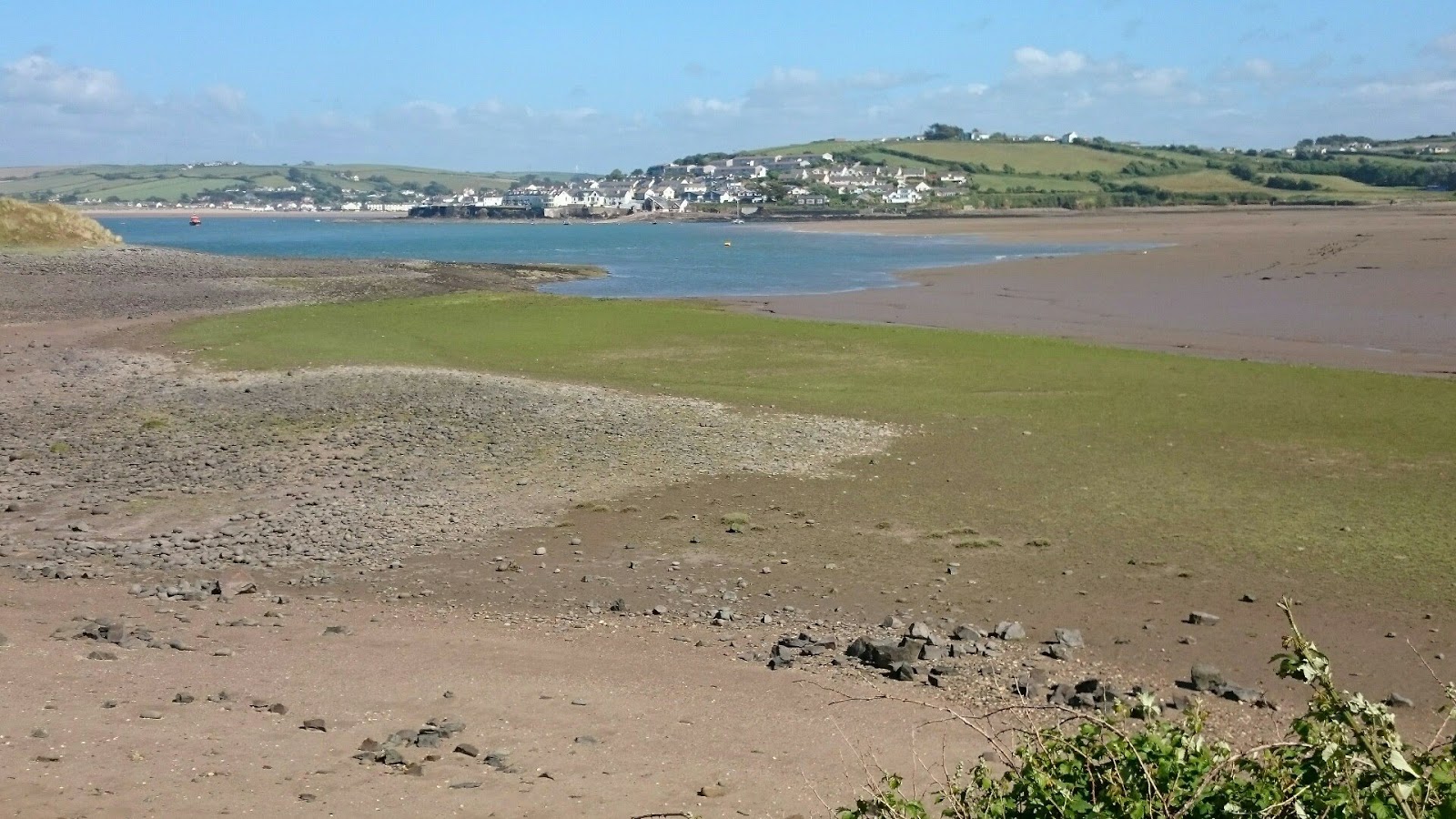


Appledore was a lovely surprise. It's meant as a compliment to say it's like a Cornish fishing village - all narrow streets and tiny houses tucked in to odd corners - and with the huge estuary to play in. I'd love to come back and explore again but out of season.

I'm staying there tonight and thinking of taking the ferry to Instow tomorrow to avoid a long road route to the bridge and back. It's not the standard approved route but then the ferry wasn't there when they drew up the route so I think it's fair enough.
Slightly cheating though.

Am I bovvered?

So tomorrow I should make it to Barnstaple - my aimed-for starting point on the final week.

Just might make it, y'know?

Peter

Wednesday, June 13, 2018

Hartland Quay to Clovelly: such is life.

We thought today was going to be relatively a doddle after the rigours of the previous days. Statistically it was: way less climbing for example and long sections of flattish cliff top. It certainly had its own challenges though - walking sloping, path-less field boundaries very tiring. As became the theme: such is life. Quite. Absolutely. Precisely. etc. Komoot summary here. 

A rather misty start: not used to this but a welcome respite from the sun.
A few ups and downs to get the cardio going of course and our first objective was the Hartland Point lighthouse. Well before that though, we were easily passed early on by Ben - a 30-year old walker who'd started at South Haven Point (Studland, effectively) just 17 days ago and had been averaging 30 miles a day. Maximum respect. His approach was to carry only a sleeping bag and a bivvy bag and just bed down at the end of the day, taking meals along the route and stopping at the occasional hostel. Nice guy and we thought he'd leave us way behind. Wrong.

Approaching Blagdon Mouth we started to see Lundy Island in the murky distance. Frankly you can barely see it in this photo - it never really got any clearer


but what we did see was a delightful field of foxgloves. I've never seen so many together (what's the collective term - heartstopper?) and it brought out the David Bailey in both of us.


There are really very few buildings or settlements round here, it is very bleak, which makes it all the more remarkable that Hartland Quay was built at all.
It has been, like so many rocky headlands, the site of too many shipwrecks and not surprisingly there's a lighthouse here: automatic of course, Trinity House stopped manning lighthouses some years ago.


There is also a monument to the torpedoe-ing of a hospital ship in WW2, only put there in 2002 so some memories are still quite raw.

Just round the headland (we'd turned a corner now and were heading East) we found a cafe and stopped for a treat: my usual flapjack health food and some coconut and chocolate monstrosity for Nic. It was then we saw Ben again, looking decidedly the worse for wear. He'd only stopped walking at 10 pm the previous night, hadn't had enough to eat or drink and was struggling. Looked like he'd had too much sun as well. He waved away our concerns and we left him resting his head on the picnic bench. I'm sure he'll be fine (he's only 30: still immortal) but it was another lesson in how these trails can cause problems if you don't look after yourself properly. Been there, suffered that (See Zennor mishaps).

From here pretty much all the way to Clovelly was high clifftop walking, with just the occasional respite as the path dipped into some wooded valleys. Not the most scenic, and difficult to get close enough to the edge for decent photographs. To start with we enjoyed the flat going but this was short-lived. The path was mostly along field boundaries but very indistinct, sloping and difficult to walk on with any rhythm. We ended up cursing it. Plenty of horseflies too, that enjoyed my arms, just to add to the experience.

We did come across a monument that I'd been keen to find, to a Wellington bomber crew who sadly flew into the cliffside in April 1942
Interesting to note the variety of crew (Canadian, New Zealand and RAF) and the junior ranks: no one above pilot officer.

And so we approached Clovelly, passing Mouthmill and its Blackchurch rock and found this shelter. It's called the Angels Wings shelter because of the elegant carvings of angels and angels wings supporting the roof. It was built in the 19th century by Sir James Hamlyn Williams, a former owner of Clovelly, so that he could look across Bideford Bay towards where his daughter, Lady Chichester, lived at Youlston. 

We made it to Clovelly which I had last visited with Karen and I let Nic go in to the village alone - it's incredibly steep and I'd had enough. It is fascinating though and should you get the chance is a must-see.
Described by Susan Coolidge in the Katy series as “..built on the sides of a crack in a tremendous cliff; the "street" is merely the bottom of the crack, into which the ingenuity of man has fitted a few stones, set slant-wise, with intersecting ridges on which the foot can catch as it goes slipping hopelessly down”. It has a steep (400 ft drop) entirely pedestrianised street with no vehicular access, deliveries are made by sled down the cobbles and waste is slid down to the harbour. 71 of the buildings are listed, more than 50 of those on the main street and some of the buildings are over 500 years old. It is a quite extraordinary place.
Unusually. the village is still privately owned and has been associated with only three families since the middle of the 13th century, nearly 800 years. It is currently run by an Estate company led by the Hon John Rous, a descendant of the Hamlyn family who have owned the village, estate and manor house Clovelly Court since 1738.
Novelist Charles Kingsley lived here for 5 years, his father was curate and rector, and his novel Westward Ho! (I'm ashamed to say I've never read it) helped to promote tourism here. It has had mentions in books by Charles Dickens and Rudyard Kipling and been painted by Whistler and Turner. Joss Ackland lives nearby.
In an 18th century chapbook The History of John Gregg and his Family of Robbers and Murderers  "Chovaley" (i.e. Clovelly) was once the home of a tribe of cannibalistic bandits where Gregg and his extended family of dozens, having committed over 1,000 murders were eventually tracked down by bloodhounds and were burnt alive in three fires. They were said to have lived in "a cave near the sea-side". It is fiction but there is a section of the local cliff called the Devil’s Kitchen.
Just so you get some idea, here's a picture I culled which gives some idea of the steepness of the main street:
Main street, Clovelly


Nic leaves tomorrow to go back to his high-paced (relative to me anyway) London life. We're certainly a good double act on bizarre conversation, if occasionally it gets embarrassing: we were talking about how Stephen Hawking could have managed to have children when we rounded the corner to find a couple most amused to have overheard such discussion in the middle of nowhere! Such is Life.

Tomorrow is Westward Ho! - Ho!pefully - and an explanation of the exclamation mark: the only town in the UK to have one. Stay tuned....

Peter


Tuesday, June 12, 2018

Morwenstow to Hartland Quay

Right, final part of the Severe section seen off and a spectacular finish at Hartland Quay. A shorter leg than usual (and a lot less than yesterday) but as expected a tough one and we were happy to call it a day by 4 pm. Usual Komoot summary here.
We started in the churchyard at Morwenstow, with this weird effigy on a post with no explanation:


I have no idea what this is about.The church was renovated by Rev Hawker (he of the hut) and I learned from Rob at the Bush Inn that he also was responsible for building a school, the vicarage, a bridge in Duckpool and sundry other ventures. Clearly a philanthropist he did a lot to improve the situation of the villagers in his parish (although it turns out it was his wife's money that funded all this!) So maybe he's allowed an eccentricity or two. If it's his.


Apparently he also changed the name of the village from Morwinstow, meaning something like a wet windy place on the moor, to the current more pleasing (to his ear) name. I think this all predated Poldark's Morwenna, though.


The path took us straight back to the cliffs I'd left the night before and they were just as spectacular.

A particular feature along this section is the striated rock formations. Bearing in mind that these are sedimentary rocks and therefore were originally horizontal it is easy to see the extent of upheavals over the millennia. Some strata are now vertical.

And Litter Mouth certainly looks well named, for the abundance of rough rocks strewn over the beach.


It wasn't long before we left Cornwall, and they feel strongly about that sort of thing here, reminding us of the fact even on as remote a place as the coast path. There's an equivalent one the other side of course, announcing Cornwall.


From here to Hartland Quay there was very little habitation, it really is very bleak along here. Although it looks magnificent on a hot sunny day I'm guessing it's another story in a storm. Rob (again) told me they'd had to effectively close the Coast Path around Easter when there was so much rain the mud made it impossible. Now what does that remind me of? (clue: Fowey and what followed)

There was the occasional place like this where the owners have done a great job to renovate and extend. Definitely a good place to chill out


One curiosity was Ronald Duncan's writing hut.


 It sounds a Scottish sort of name but he was born Ronald Frederick Henry Dunkelsbühler in Zimbabwe. He was a poet, author and playwright, read English at Cambridge, wrote some libretti for Benjamin Britten (incl Rape of Lucretia) and was a noted pacifist, setting up a co-operative farm near here. He also wrote the script for Girl on a Motorcycle starring Marianne Faithfull. He wrote many of his poetry and plays at this hut and it is kept open during the day for anyone to use.

After a tough few ups and downs (we counted 4 on this section and I think there were at least 6 on yesterday's) we came to Welcome Mouth. Again you can see the continuing rock strata on the beach


Unbeknown to us the climb up from here is pretty much the last hurrah for the ascents and then it's easy walking along cliff tops . 
Nic was so pleased to be told that it was flat from here that he promptly proposed to the woman who told him, much to her husband's bemusement. 
The Landscape's just as amazing as before:


and the local herd came to check us out - very inquisitive as ever.


So finally we got to Hartland Quay. Given its location it's hard to get a good picture so I grabbed this one off the net and you can see why. It is in a superb position - driving down to it feels like you're going to go over the edge of the cliff!


The harbour dated back to the time of Henry VIII until a storm led to the complete destruction of the pier head and later the whole pier wall in 1887. Parts of the old formation stones can be seen at low tide. The old Customs House (where I'm staying) has been a hotel since 1886 and its former stables are now 'The Wrecker's Retreat' bar. There is an Abbey here in nearby Hartland which was the last to be disestablished by Henry VIII, who gave it to his sergeant of the wine cellar, appropriately enough. Parts of it featured in the BBC’s 2008 Sense and Sensibility. 

Mary Norton, who wrote the Borrowers novels, is buried nearby. Films shot here include Treasure Island (1950) and Solomon Kane (2009).

Couldn't resist a sunset photo, given I never quite made it to one in Portugal 😀

Tomorrow off to Clovelly though the path doesn't take us right through it. Last day for Nic who has to go back to London. It's been great to have his support - no-one got past today without a smart remark from one or the other of us!

Peter

Monday, June 11, 2018

Crackington Haven to Morwenstow


Here we go again, back on the trail after a lazy few weeks in Ireland and Scotland. Although it has to be said the hills are a lot bigger in Scotland. Especially Ben Nevis. Thanks to Clan Skinner for a fantastic intro to Monroes, and a warm welcome into the extended (and extensive) family celebrations.
So as they say in these parts "dydh da dhe my nowydh koweth brynken" or, Hello. It's good to be walking again and especially because today was an epic day: 17+ miles, over 3,000 feet and reached the last parish in Cornwall. Komoot summary here. 
Started at Crackington Haven from where you may remember Natasha drove me back to Tintagel last time. Since I contrived to lock myself out from the hotel the first morning (B'fast doesn't start 'til 8.30 and no-one around in the early morning) I wandered over to get an update. Turns out she got the bees but they all flew off pretty quickly! So that's two things not going according to plan, hope it's not an omen for today.
I shouldn't have worried. It was a beautiful morning to start, though too warm for my taste
Looking back I can now see the huge hills I climbed last time that were covered in cloud then. Fearsome.

Until the nineteenth century, Crackington Haven was a small port similar to many others on the north coast of Cornwall. Limestone and coal were imported and slate and other local produce were exported. After the railways reached the district in 1893 the village could be reached more easily (from the station at Otterham) so holidaymaking became more common.

I'm not as well equipped for hot weather walking but a full-zip cycling top and broad brimmed sun hat were about right (+ warp factor 50). Long trousers essential despite the heat, for getting through thigh-high nettle patches unscathed. New boots, as my beloved Loma had split their stitching, from Merrell and I'm off.
This section passes along a coastline with dramatic rock formations. Bear in mind that these layers used to be horizontal until some ancient upheavals:


Since my last visit all the plants have shot up and some sections were savannah high. I think grasses are much under-rated and they were looking particularly awesome, as were the foxgloves

This is a pretty hilly section, as befits the rock formations, but eventually the path comes out onto a stretch of cliff tops and the walking gets easier. The white domes and dishes of GCHQ just discernible in the murky distance. Appropriate for spooks, perhaps.

 The path comes down into the tiny hamlet of Millook (as in: has Millookk changed - not a lot: groan).
In 2014 the cliffs at Millook Haven were voted by the Geological Society of London as one of Britain's top 10 geological sites, leading the "folding and faulting" category. Described in a 1993 report as the “best ravine wood in Cornwall” the site was previously listed as a Site of Special Scientific Interest (SSSI). Composed mainly of large pebbles and coarse shingle, it isn't a bathing beach but is a well known spot amongst experienced surfers. On a peaceful sunny day it just looked a picture. Perhaps less so on a stormy Sou'Westerly.


They clearly take their fishing seriously, I've never seen this kind of notice before.


From there it's up another cliff and almost suddenly there is Widemouth Bay. Can't think why they called this enormous beach that. Karen and I rented one of the houses here - a beautifully appointed eco-house with ground source heating, solar thermal, and a green roof. One of the best we had and the girls plus Steve and Arthur joined us. As I recall, I was the only one to 'brave' the sea, albeit in a wet suit and only for about 5 minutes. Wuss)

It's then a long trudge across the back of the beach to the cliffs on the far side. The striking rock formations can be seen all along here.
Called locally ‘Widmouth Bay’, just so you know. Widemouth Bay is very long open bay popular with families and surfers and at low tide there are hundreds of rock pools to explore. This stretch of coast is steeped in smuggling history and not far south there are many little inlets and coves. Sloops from Wales would use Widemouth as a port (in the most basic sense), unloading coal and limestone; sloops would take back to Wales Cornish wares such as granite, slate, tin, copper and even Cornish pasties The gentle beaches in the bay are also the landing points for many submarine cables that link the UK with other parts of the world. The proximity to GCHQ Bude installation allows data sent on these cables to be intercepted by them.

The path then pretty much follows the road until, just before Bude, revealing the beach that I never knew it had and the well known Compass Point. This octagonal former coastguard lookout with the compass points carved onto its sides is modelled on the Temple of Winds in Athens.


You can see here the end of the old harbour works. The cliffs around Bude are the only ones in Cornwall that are made of Carboniferous sandstone, as most of the Cornish coast is formed of Devonian Slate, Granite and Precambrian metamorphic rocks. The figurehead of the Bencoolen, a barque wrecked on the reefs at the base of the cliffs in 1862 is in the town museum. Until the start of the 20th century, the neighbouring town of Stratton was dominant: as locals say "Stratton was a market town when Bude was just a furzy down" (furze means gorse hereabouts)

There is a canal here that used to run all the way to Launceston, but is now only a few miles long. Originally built by the Bude Canal Company (who’d have guessed) in the 17th century, it has a wharf connecting to the tidal basin with the only manually operated sea lock gates in England. 


Because the sands at Bude are unique for these parts in containing the fertiliser calcium carbonate, the canal was developed to take loads inland to spread on the fields. The advent of the railways, developed partly in response to the rise in Victorian tourism, heralded its decline but the port continued for some time swapping Cornish grain with Welsh coal.

Bude Castle, now a heritage centre, was built about 1830 for Victorian inventor Sir Goldsworth Gurney – developer of the oxy-hydrogen blowpipe. 
The UK's top manufacturer of air rifle tuning kits, Tinbum (!) Tuning are based just outside of the town – wonder what they used for target practice?
Jean Rhys started her novel The Wide Sargasso Sea while living in Bude in the 1950s and Tori Amos has a home and studio here.

Bude also has a tidal sea-bathing pool which was not obviously very popular the day I passed through.

Originally I'd intended stopping here, for the next leg (Bude to Hartland Quay) is 15 miles and 4,300 feet, rated 'Severe' - one of the few such sections on the entire path (although, mercifully, the last).
However I'd made good time, reaching Bude for lunch of onion soup at the cafe, so much fortified I pressed on.
Well the book didn't lie. The severity lies not in the absolute heights (nothing compared to even a modest Monroe) but in the relentless rise and fall, about 10 250ft-ish over the next seven miles and of course down as well as up. Thank goodness I had the poles. In each of the dips is usually a small hamlet or a cafe and many can be reached by car. Northcott, Sandy Mouth and Duckpool all well worth a visit though probably best out of season.
Northcott

Approaching Sandy Mouth
Duckpool
Each time I thought maybe I'd stop there but I still had plenty of time so again, on I pressed.
At Sharpnose Point (aptly named when you see it) there's an old Coastguard lookout 

It's a shame that all these fell into disrepair when HMCG withdrew its watchers but perhaps this will be rescued like so many others by the National Coastwatch Institution ("Eyes Along the Coast" or more popularly "On the Lookout for Trouble")

Sharpnose Point is the headland at the GCHQ site, a listening station which routinely monitors both satellite and cable traffic. It was paid for largely by the US’s NSA but is run by GCHQ. A 2014 Horizon programme claimed that several large submarine ethernet cables relay copies of the undersea cable traffic (estimated to be 25% of all internet traffic) to GCHQ which then has 30 days to analyse it. The cables have the capacity to transfer the entire digitised British Library in about 40 seconds.

From here it was one last up-and-down and then I took the path inland to Morwenstow, the most northerly parish in Cornwall. Robert Stephen Hawker, who wrote the Cornish anthem Trelawney lived here. His ‘Hawker’s Hut’, looking out to Lundy, remains here in the cliffside. There is a manor house at Stanbury said to be haunted, as is the Tudor Tonacombe Manor.
Set in Stone, the mystery thriller by Robert Goddard is largely based here and Jonah Barrington, my squash hero from the 70s, was born here.
So, finally, into the pub at Morwenstow, The Bush Inn:
They were horrified to hear that I wanted a taxi back to Crackington Haven so, just as happened to me there, Rob insisted on taking me back himself for a lot less cost. Very entrepreneurial round here 😀.
I learned from Rob that outsiders/tourists are known in Devon ("don't you swear in my car") as grockles but in Cornwall as Emmets. This is a Cornish word meaning ant because of the way they get everywhere and are just generally annoying, I suppose.

Well having thus walked half of the 'Severe' section (Rob says the next bit's worse. Thanks Rob) tomorrow is the next bit and Nic has joined me for a couple of days. It'll be good to have the company and chew the fat about important matters of state and so forth as we make our intellectual way. Hmm. Something like that, but good of him to join me. Now he can suffer my ramblings instead of me talking to myself.